There are many useful applications of location-based foot traffic measurement, including:
- Market research
- Site selection for a new location
- Location performance benchmarking
- Competitor conquesting
- Traffic analysis for OOH ad placements
- Attribution & results measurement pre, during, or post advertising campaign
However, scaling up your location measurement efforts, while providing accurate foot traffic analytics can be challenging. Many companies that claim to have foot traffic measurement are utilizing panel-based modeling to extrapolate visitor metrics that are not representative of actual visitors to your locations. OnSpot provides real, observed visitor data for any given location in the United States that is never modeled or padded.
What is the OnSpot Auto-Polgyon Tool?
OnSpot provides two main options for automatically creating polygons, or Geoframes, around a set of locations to anonymously capture foot traffic over a specified period of time:
Commercial Address Upload – Known lists of business addresses from outside data sources can be quickly imported into our platform.
Quick Select – Query our database of over 16 Million business locations, including major regional and national brand names, by state, city, or zip code.
What are the Benefits?
Efficiency + Accuracy – scale up how your team measures foot traffic, creates audiences for advertising campaigns, and measures visitor lift with just a few clicks, knowing that the underlying visitor data is accurate and reliable. Audiences created will be available for reporting and activation same-day.
Insight + Analytics– Any set of locations created with the OnSpot Auto-Polygon functionality includes robust insights into visitor behavioral trends, demographic data, and more.
Precision Targeting + Activation– Any set of locations will become an audience that can be utilized in an advertising campaign with a few simple steps, and those visitors can be served with multi-channel messaging on Programmatic, Social Media, and Direct Mail.
Measurement + Results – How effective was your campaign at driving additional foot traffic? Are those passing by your OOH placement actually purchasing in-store? These questions and more can be answered by utilizing our Attribution reporting tools to drive data-driven decision making to inform your marketing strategy.
How Does it Work?
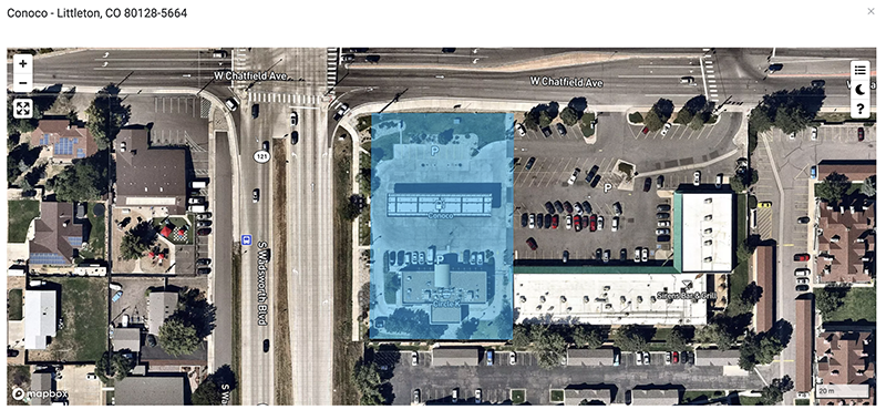
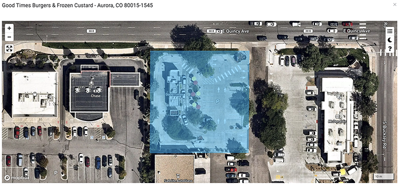
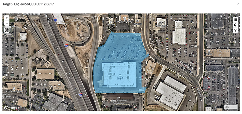
Whether you utilize our upload capabilities or Quick Select tool, Our Auto-polygon process will create a boundary around the location based on the business address. Boundaries are determined by the land parcel that the business is located on, and will often include associated parking lots and areas where visitors travel to and from the business locations. Below are a few examples of what the Auto-polygon tool produces in minutes:
Gas Station and Convenience Store:

Fast Food Restaurant:

Big Box Retailer:


